Step 3: Site Commissioning
A systematic approach for commissioning

1
Gateway
Installation

2
Gateway onboarding
on NMS

3
Meter installation as
per RF deployment plan

4
Gateway location
iteration, if required

5
Network
Stabilisation
Map tool to monitor installation of DCUs
- Capability to map latitude and longitude
- Keep check on installation progress
- Provides accurate picture of mesh formation on field
NMS utilisation for Gateway on-boarding
- Track communication and mesh formation
- Evaluate network formation
- Track network stabilisation
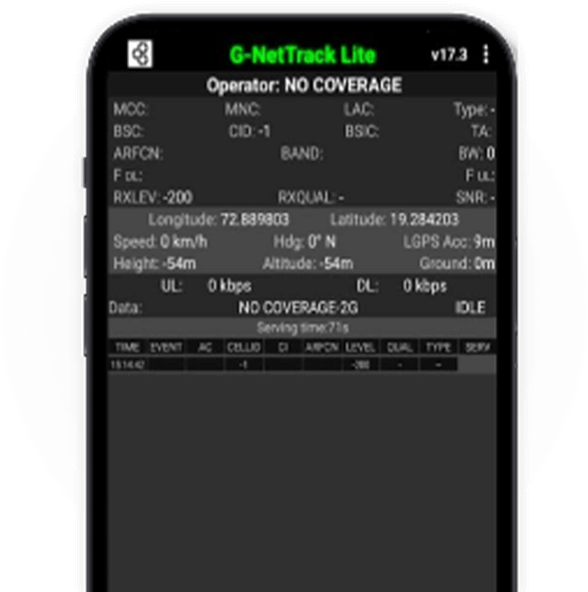
G-Net Track Lite
- Evaluate signal strength
- Plan data transmission with added antennas as needed
- Adjust DCU location based on network availability